Paddle Through Past Landscapes Along Remote Cat Point Creek
By Leslie Middleton. Photos by Dave Harp.
Early morning light beckoned me upstream into the green, marshy world of Cat Point Creek, a tributary of Virginia's Rappahannock River.
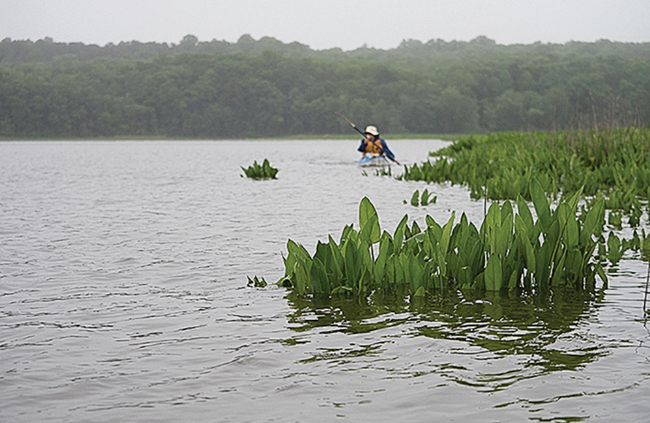
I paddled the creek's narrow path through pastures of arrow arum, past tight fists of yellow pond lilies that had begun their spring unfurling. Blue flag irises were emerging from ferns that had found a toehold in boggy soil amongst the roots of a small, red maple.
The rhythmic swirl of water eddied off the paddles, occasionally interrupted by sounds from the marsh: The slap of a beaver marking its territory before sliding, unseen, beneath the flatwater to the tangled woodwork of its den. The cry of a pileated woodpecker on its trajectory through the creek's forested valley.
Cat Point Creek offered such a complete feeling of remoteness that I felt I must be close to experiencing the land - and waterway - much as it had been before English settlers came to the area.
I'd set off that morning from a launch downstream at the historic site of Menokin, the 1769 home of Francis Lightfoot Lee, who signed the Declaration of Independence. The grounds include a recently improved launch site for canoes and kayaks. My paddling companion was Alice French, the Menokin Foundation's educator, whose job includes taking visitors onto Cat Point Creek from spring to fall.

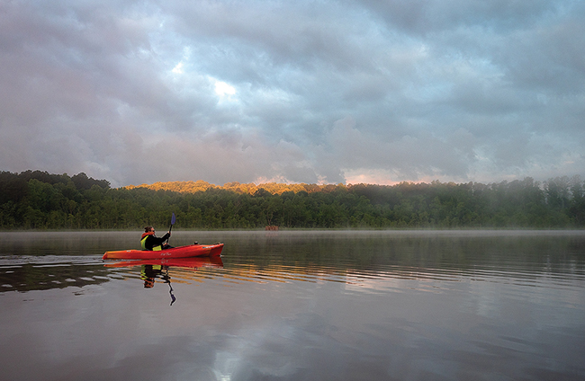
A kayaker enjoys a serene paddle on Cat Point Creek in Virginia through the early morning mist.
Menokin offers the only public boat launch on Cat Point Creek, so paddlers are often found heading down the hill behind the remains of the Lee family's house, now undergoing restoration to showcase Colonial building methods. The road descends through towering tulip trees that date to the early 1800s.
The launch site itself was once the plantation's bustling wharf at the end of a "rolling road," where large casks of tobacco were rolled downhill to waiting ships. The road is still evident as a deep depression alongside the path to the launch site.
Cat Point Creek stretches 19 sinuous miles, roughly north to south, across almost the entire width of Virginia's Northern Neck. And although the creek is a Rappahannock tributary, its headwaters are just a half-mile shy of the Potomac River.
A satellite image of this portion of "the Neck" shows the dendritic tendrils of Cat Point and other creeks that empty into the Rappahannock. They cut into sediment laid down eons ago, giving way to modest escarpments above which Native Americans and then colonists established settlements. Now covered in forest, they flank either side of Cat Point Creek at the far edges of the wide, watery valley.
As we paddled upstream from Menokin Bay, the creek was narrow and boggy. Here and there, a thin white PVC pipe marked possible channels, but at times the waterway got so narrow we were forced to back out and try another route.
I'd been told that during the high tide - and after a lot of rain - we might be able to paddle another five miles upstream if we were willing to navigate downed trees and an uncertain pathway through dense wetlands. That kind of adventure would have to wait for another day.
After a slow mile upstream, stopping to admire the blooms of Virginia sweetspire and the delicate evening primrose, we headed back to Menokin Bay. It was only on the return trip that I saw a single house in the distance.

The freshwater marshes of Cat Point Creek, a tributary of the Rappahannock River in Virginia, offer perfect habitat for largemouth bass, crappie, rockfish and catfish..
I wanted to see the downstream stretch of the creek, too, as it winds its way to the Rappahannock. On a different day, after setting up a return shuttle, I launched from Menokin during a slight drizzle.
The creek's serpentine curves became more obvious as I paddled. Each was bounded by solid, tree-covered banks pockmarked by dark holes where kingfishers and other animals burrowed.
Scraggy roots of mountain azalea clung to the bare soil of these north-facing cliffs, refuge pockets for plants more commonly found in Virginia's higher elevations. Every so often, a large splash roiled the water nearby, possibly a blue catfish or gar. An immature bald eagle followed us downriver, stopping on tree snags along the way.
Long before Cat Point Creek became one of several designated "water trails" on Virginia's Northern Neck, it was for eons one of many watery pathways integral to the lives of the local indigenous peoples. In 1608, Capt. John Smith recorded 14 Rappahannock Indian settlements on the north side of the river and its tributaries. The lands surrounding Cat Point Creek offered superior soils for small-scale agriculture and pottery making.
These same rich soils and elevated plateaus were attractive to English settlers, too. By the late 1600s, the Rappahannock had been mostly displaced from their homeland.
The Menokin plantation was not the only large farm along Cat Point Creek during the colonial era. Just downstream from Menokin is Mt. Airy, owned by the Tayloe family for more than 250 years. Tenth generation Tayloe Emery lives there today with his wife and two children, who are growing up, like their forebears, with a close relationship to the creek.
"We have some old letters between John Tayloe and George Washington, talking about duck hunting," Emery told me. "I like to think of the creek as where George Washington used to shoot his dinner."
Emery has a conservation easement on much of his property, ensuring protection into perpetuity.
In all, more than 10% of the 48,000 acres of the creek's watershed is protected by easements. The Tayloe Tract, close to the mouth of the creek, was the U.S. Fish & Wildlife Service's first acquisition of the Rappahannock River Valley National Wildlife Refuge.
Today, the agency manages several parcels along the creek set aside for wetlands, water quality, wildlife and especially waterfowl. Headed down the creek toward the river, we passed multiple duck blinds perched on the edge of the creek.

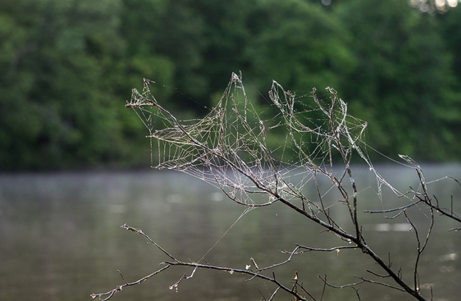
A delicate web weaves through bare branches along the shore of Cat Point Creek in Virginia.
After several days of rain, the creek's downstream flow matched the tidal current headed upstream, and the wind was thankfully behind us. There was no one else on the water - not unusual, according to those who frequent the creek. But we continued to be followed by a mature bald eagle, which was joined from time to time by an immature eagle.
Bill Portlock, senior educator for the Chesapeake Bay Foundation, has paddled here in every season for many years, often as part of the annual winter bald eagle survey conducted by the College of William and Mary. It's not uncommon, he said, to find eagles there in large numbers.
"There are eagles perched on the edges of the marsh everywhere - so many that we often have to stop the boat to make an accurate count," he said.
Portlock attributes this to the wide variety of life found in the creek's ecosystem and said the diversity is driven in part by its location.
"Cat Point Creek is located right at the cusp where the salt wedge coming up the Rappahannock from the Chesapeake Bay runs under the fresh water coming downstream," he explained. The upwelling is the source of biological productivity in the river and the creek.
Richard Moncure, tidal river steward for Friends of the Rappahannock, has spent much of his life on the Rappahannock and often leads educational trips on Cat Point Creek.
"The creek is like a microcosm of the entire Rappahannock River: brackish at its mouth, becoming fresher the farther upstream you go. It's a great place for teaching about watersheds, and it's still relatively pristine," he said.
And, according to Moncure, it is "perfectly underutilized."
The stretch of the creek from Menokin Bay south to the Rappahannock River is crossed by two low bridges, limiting power boat traffic to those well-timed to the tides. "It's ideal for kayaks and other small watercraft," he said.
The wind picked up as we paddled under Newland Road, the second of these bridges, right as Cat Point Creek widens onto the river. It took some work to paddle upriver to our take-out at Naylor's Beach Campground. The Rappahannock is a couple of miles wide here, and I missed the intimacy of the creek's marshy, serpentine channel.
Another day - another season - I'll return. Maybe in the late summer, when the arrow arum's dark sticky seeds are forming the winter food for ducks, or in the fall, when the wild rice lets loose on the water. Maybe next spring, as the green of the freshwater marsh is just emerging.
No matter when, I'm reasonably confident this unique and highly protected landscape will have changed little.
Bill Crouch, assistant manager for the Rappahannock River Valley refuge, puts it this way: "Cat Point Creek comes very close to the character of wilderness that so many of us seek... untrammeled, and mostly unaltered by man."
Resources
The paddle launch and kayak rentals are available at Menokin during daylight hours. Visit menokin.org or call 804-333-1776.
For a digital map of the water trails on the Northern Neck of Virginia, including Cat Point Creek, visit virginiawatertrails.org.
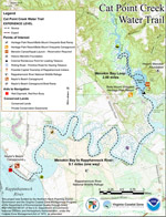
 Click image for PDF describing the water trail.

|
Leslie Middleton writes about water quality, public access, and the special places of the Chesapeake Bay region from her home in Charlottesville, Virginia. Click image for more articles by Leslie.
|
